
Geographic Map of the United States
Geographic Map of the United States
The United States of America is bounded in their natural borders from Canada to the north and from Mexico to the south. With its 9,872,615 km², the United States is the fourth largest country in the world by surface.
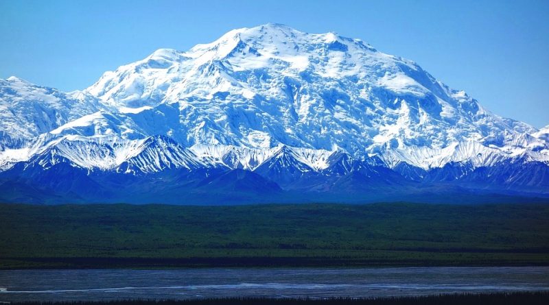
The United States of America is characterized by mountain ranges and plateaus of not considerable elevation, compared to the European and especially the Himalayan Asian systems. The main mountain ranges of the United States of America are the Appalachians and the Rockies that surround the Great Inner Plains. The Appalachians, located in the eastern part of the country, reach a maximum height of 2036 m. s.l.m .. The Rocky Mountains occupy a large part of US territory and reach 6.194 m. with Mount Denali in Alaska.
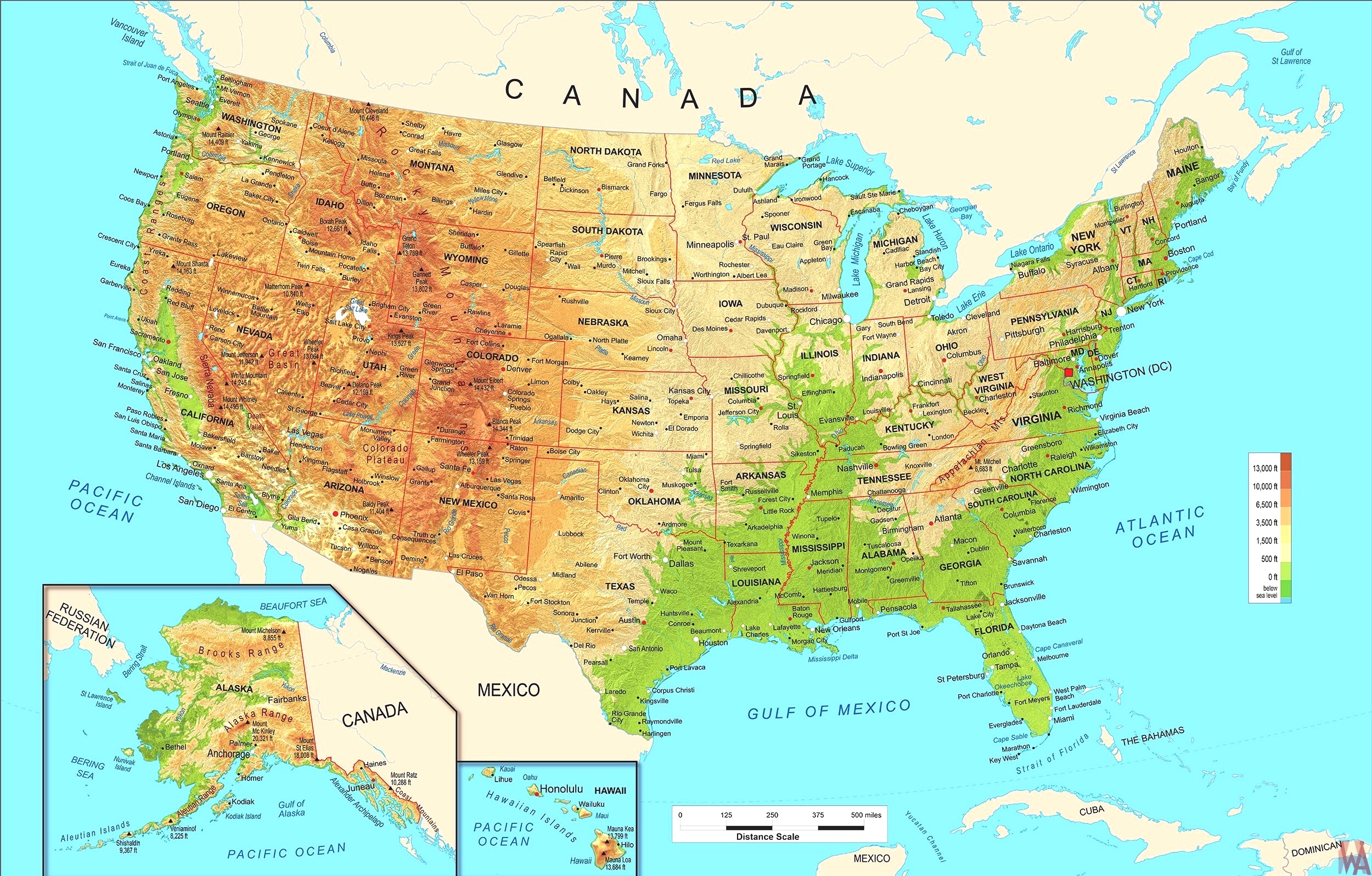
The great plains are crossed by rivers with modest slopes. The longest river is the Mississippi, which flows in the center of the country and flows with a vast delta in the Gulf of Mexico. Among its tributaries there are numerous other major rivers, including Missouri, Ohio, Arkansas, Kansas, Red River, Illinois, Yellowstone, Tennessee and Platte. The Rio Grande, together with the tributary Pecos, marks a large part of the border with Mexico.
Important are the US lakes that are found mainly in the Great Lakes region, on the border between the United States and Canada; here are some of the largest lakes in the world; we especially remember the Upper Lake.
Also worth mentioning is the Great Salt Lake, in the Rocky Mountains, which is one of the largest salt lakes in the world. The lakes are interconnected but arranged at different altitudes, in particular the Erie pours into Ontario its waters with a jump of 100 m forming numerous waterfalls such as the Niagara waterfall.
Guido Bissanti