
Geographic map of North Korea
Geographic map of North Korea
North Korea is an East Asian state that occupies the northern part of the Korean peninsula, bordering China to the north and Russia for a short distance, while the Korean demilitarized zone separates it from South Korea to the south. to the west it is bordered by the Yellow Sea and to the east by the Sea of Japan.
North Korea has a population of 25,643,466 (2020 data) and covers an area of 120,540 km².
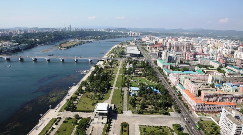
The capital is: Pyongyang with 3,255. 288 inhabitants (as of 2018).
Geography –
Geographically, North Korea is located in the northern part of the Korean peninsula, between the 37th and 43rd parallel north and between the 124th and 131st meridian east.
This country borders China and Russia to the north and South Korea to the south, along the Korean demilitarized zone. North Korea faces the Yellow Sea and Korea Bay to the west and the Sea of Japan to the east.
80% of North Korea is made up of mountains and plateaus, separated by deep, narrow valleys. All the mountains on the Korean peninsula with an altitude above 2,000 meters are located in North Korea. The highest point of the country is Mount Paektu, a mountain of volcanic origin 2,744 meters high. Other important reliefs are: the Hamgyŏng mountains, located in the extreme north-east of the country and the Rangnim mountains, located in the central-northern area, the Kumgang and Taebaek mountains which extend south beyond South Korea.
To the west we find the major plain areas while to the east they develop in stretches.

Climate –
In North Korea, the climate is continental, with cold but sunny winters and hot, rainy summers.
The country is affected by the monsoons: during the winter the cold north-west winds of Siberian origin prevail, while in the summer the southern currents of tropical origin prevail.
For this reason, North Korea has a rainfall regime opposite to that of the Mediterranean: the driest months are winter, while the wettest are July and August. The rains associated with the summer monsoon can sometimes be very abundant and cause flooding (as happened, for example, in August 2007 or July 2012).
In summer and early autumn, the country can be hit by typhoons.
In the north, largely occupied by hills and mountains, winter is freezing and sunny, as air masses of Siberian origin prevail there. In summer, temperatures vary with altitude, and at low altitudes it is hot. The rains are concentrated in the period May-September. Although the winter is dry, it can sometimes snow.
In Hyesan, a city located in the far north, on the border with China and at an altitude of 700 meters, the average January temperature is -15.5 °C. The temperature drops below -5 °C for 150 days a year, and this happens from October to April. The cold record is -37.2 °C, recorded in January 1959, while in January 2018 the temperature dropped to -34 °C.
In summer there are quite cool periods, but also hot periods, in which the temperature exceeds 30 °C, sometimes as early as the end of May, before the monsoon. The heat record is 38.3 °C, set in August 2016.
Precipitation in the north is quite scarce, and in Hyesan it exceeds 100mm per month only in July and August. Here are the average temperatures.
Inside North Korea there are mountainous areas, where the climate gets even colder, and during the winter it can drop to -40 °C at the worst times. The highest ranges are located in the northeast, and are the Rangrim mountains, whose highest peak is the Wagalbong, 2,260 meters high, and the Hamgyong mountains, which include several peaks exceeding 2,000 meters; the highest is Mount Kwanmo (2,540 meters).
However, the highest peak in the country, and the sacred mountain of Koreans, is Mount Paektu, also known as Baekdu and Baitou, located in the north-east, on the border with China, and 2,744 meters high. It is a volcano, in the center of which there is a caldera occupied by a lake, called “the lake of Paradise”, formed following the great eruption of 946 AD. Snow can cover the summit until June.
In the north-eastern part of the coast, towards the border with Russia, the climate is colder than in the central-south, both due to the higher latitude and the presence of a cold sea current (the Liman current).
In the north-east, the climate is quite arid, as cold air from the north prevails for most of the year, and the summer monsoon arrives with more difficulty. However, summer is also the rainiest season here.
In the north-east, the sea, close to freezing in winter, remains cool in summer, reaching a maximum of 21 °C in August.
In the south-central part of North Korea, the climate is milder, however, winter is still very cold, especially on the west coast and inland areas.
The capital, Pyongyang, is located on the western side, about forty kilometers from the coast of the Yellow Sea. In winter, during cold spells it can drop below -20 °C; in January 2001 the temperature dropped to -26.5°C.
Summer is sultry hot, and in periods of good weather the temperature can reach 34/35 °C. The heat record is 38°C, set in August 2018.
In Pyongyang, rainfall amounts to 935 millimeters (37 inches) per year, so they are quite abundant, even if they are concentrated from May to September; in winter they are instead scarce, and given the temperatures, they occur in the form of snow.
The amount of sunshine in North Korea is never low, on the contrary it is moderate in winter and in the intermediate seasons, when there are many sunny days, while in summer it decreases a bit, due to the summer monsoon, which brings periods of bad weather. Here is the average number of hours of sunshine per day in Pyongyang.
On the west coast of North Korea, the Yellow Sea, very cold in winter, becomes warm enough for swimming in summer, especially in August. Here is the sea temperature in Nampo.
Along the coasts the climate is a little milder, furthermore at the same latitude the east coast, on the East Korean Sea (or Sea of Japan), is milder than the west, on the Yellow Sea.
In Wonsan, located on the east coast and on the same latitude as Pyongyang, the average January temperature is -1.5 °C. In January 2001 the temperature dropped to -18.3°C.
Here too, very hot periods can occur in summer. Indeed, the wind that comes down from the mountains located southwest of the city can bring sudden increases in temperature in all seasons. The heat record is 39.7 °C, set in July 2018.
In Wonsan, 1,350 mm (53 in) of rain fall per year; here in particular the month of September is still very rainy.
In Wonsan, too, the sun often shines for most of the year, except in summer, when the monsoon reduces the number of hours of sunshine.
On the east coast, the sea temperature in summer is 1-2 degrees lower than on the west coast, reaching a maximum of 23.5 degrees in August.
Southeast of Wonsan, the winter climate becomes even milder: in Kosong, near the border with South Korea and at the foot of Mount Kumgang (see below), the January average reaches zero degrees. In 2018, the temperature dropped to -17°C in January and hit 38°C in August.
In this area the rains are even more abundant, since they amount to 1,500 mm (59 in) per year, and in particular, they exceed 300 mm (12 in) per month in July and August.
As mentioned, North Korea can be hit by typhoons, tropical cyclones in East Asia during the summer. Typically, typhoons affect Korea from July to the beginning of October (and more rarely also in the second half of June), with a greater probability in the first half of September.
Since typhoons come from the south, they hit South Korea more directly, and that’s where the strongest winds and heaviest swells bring; in North Korea they generally bring abundant rains, which are added to those of the summer monsoon, and can cause landslides and floods.
Flora-
In North Korea, according to a 2003 survey carried out by the United Nations under the environment program, forests cover 74% of the country, mostly along the steep slopes of the mountains.
North Korea is more heavily forested than South Korea: 75% of the land is covered by a great variety of trees and plants. 70% of these plants are found in the Hamgyng Mountain Reserve and Yanggang and Jagang Provinces, which are occupied by rugged mountains covered with dense forests. In North Korea, there are nine national parks, two nature reserves, one landscape reserve, twelve natural monuments and other protected areas. More than 4,000 different plant species grow in the country, including 570 endemic to the area. The “national flower” is the hibiscus or rose marshmallow, in Korean mugunghwa, which means “flower of immortality”. It is said to well represent the tenacious character of the people of the peninsula.
The northern and eastern regions of the country are occupied by rugged mountains covered with dense forests, unsuitable for agricultural exploitation or building development.
On the entire peninsula there is a great variety of trees common to temperate climates, such as pines, larches, firs, junipers, oaks, willows, maples, alder and birches. Characteristic are the large gingko trees and Chinese elms. In the peninsula there are also Lombard poplars and acacias, trees that have been imported to combat erosion.
In Korea there is also a great profusion of flowers that bloom in the various seasons. The first to appear are the forsythia, which color the hills yellow in spring. Then there are azaleas, cherry trees, lilacs, syrinx and spirea.
North Korea has an environment law, divided into five chapters, containing 52 articles on the protection and conservation of the natural environment, pollution prevention, and environmental damage sanctions.
From Japan’s rule to today, there has never been much respect for the environment in the country; it was in fact used as a sawmill and a private mine, especially at the outbreak of the Second World War. Despite this, thanks to being largely inaccessible, North Korea has not suffered excessive damage.
Even with the Korean war and the American bombings in the 1950s there were heavy repercussions on the environment, but a large part of the country can still count on lush forests and rich mineral deposits still unexploited underground. In fact, North Korean policy has aimed on the reforestation of 914,000 hectares of land in the 1960s and 100,000 hectares in the 1970s. Today the program provides for the reforestation of another 2,900 hectares. Since 1980, the state has also decided to reduce the cutting of trees for heating, focusing on greater extraction of coal as a primary fuel.
Wildlife –
North Korea, despite the decrease due to wars and bad exploitation of the territory, is populated by a varied wildlife that today we are trying to protect in the established parks.
The most common animals are deer, roe deer, sables, brown bears, northern magpies, lynx, tigers, alpine pikas, water shrews, black grouse, howlers, pine hawfinch, woodpeckers, Amur antelope and Manchurian pheasants from collar.
Guido Bissanti